 Navibirx
Plan it. Ride it. Share it.
Navibirx plans bike rides and runs, guides you turn by turn with voice cues, and lets friends follow along live. Everything runs in your phone's browser.
No account, no app store, no ads.
Anonymous totals: users are counted once per device, and the app sends only numbers, never locations or routes.
Everything for the ride, or the run
From planning at home to the last turn, with your phone on the bars or in your hand.
Plan in seconds
Search places or tap the map, add via points such as "past the lake", or make it a round trip with a target distance.
Ride or run
Trekking, gravel, road and MTB routing for the bike; paths, parks and trails on foot. Runners see their pace in min/km.
Voice turn-by-turn
"In 200 metres, turn left." Off-track alerts point you back, or reroute you automatically, and the screen stays on.
Go together
Share a route with "ride together" on. Everyone sees each other live, who's ahead and by how much, and can send quick voice messages.
Share anything
A whole 40 km route fits inside a link. Send it in any chat, use a short link, or export GPX for OsmAnd, Komoot or Garmin.
Private by design
No accounts and no tracking. Your routes and rides stay on your phone; group locations are end-to-end encrypted. The app only adds to anonymous totals, and you can switch even that off.
Into square collecting? Switch it on in Settings to see the map squares you've already visited and plan routes through new ones.
How it works
Three screens, no learning curve.
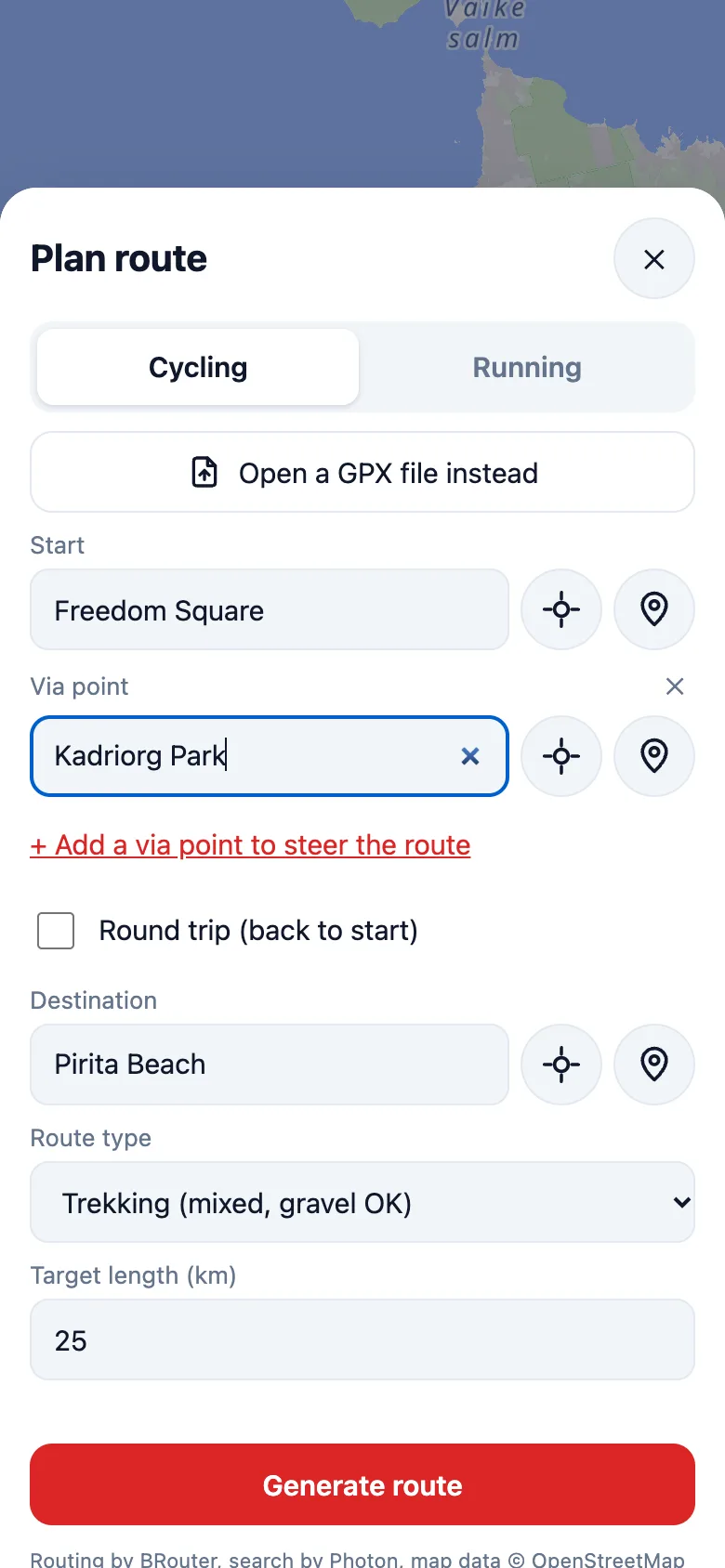
1. Plan
Search places or tap the map, add via points, and pick a route type for riding or running.
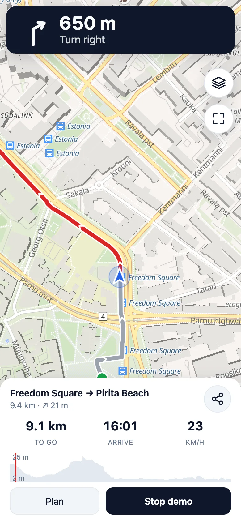
2. Ride
Turn cues on screen and by voice, distance to go, arrival time and an elevation profile.
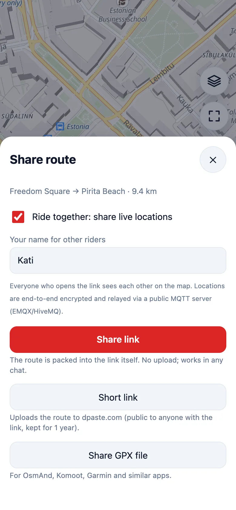
3. Share
Send the route to friends and ride together, or hand it to another navigation app.
Get started in a minute
No sign-up. Everything is saved on your device.
Open it on your phone
Go to navibirx.kuld.dev/app and add it to your home screen (Share → Add to Home Screen on iPhone, ⋮ → Install on Android).
Plan or open a route
Tap Plan, choose cycling or running and where to go, or open a GPX file you already have.
Press Start
Follow the voice cues. Want company? Share the route with "ride together" on.
Questions
Is it free?
Yes. Navibirx is a hobby project with no ads and no paid tier. Routing uses the free BRouter service and maps come from OpenFreeMap, CyclOSM and OpenStreetMap.
Do I need an account?
No. Planning, navigation, sharing and group rides work for anyone, with nothing to sign up for.
Does it work with the screen off?
Browsers pause web apps when the screen is off, so Navibirx keeps the screen on while you navigate. Use a handlebar or arm mount and, on longer outings, a power bank.
What leaves my phone?
Start, via and destination points go to BRouter (routing) and Photon (place search). Map tiles are loaded as you pan. In group rides your position is end-to-end encrypted and relayed by a public MQTT server. Short links upload the route to dpaste.com. The app also adds to the anonymous totals shown on this page (kilometres, routes planned and shared, group rides, and each device once): only the numbers, with no ID, location or route. Switch it off in Settings → Privacy. Nothing else leaves your phone.
Does it support square or tile collecting?
Yes, optionally. Switch on Square collecting in Settings and connect your square-collecting account: Navibirx then shows the squares you've visited, plans routes through new ones and cheers when you reach them. Collecting itself still happens the usual way, by recording the activity and letting that service sync it.
Does it work for running?
Yes. Switch to Running in the planner or in Settings. Routes then use footpaths, parks and trails, speed shows as pace (min/km), and you hear your split pace every kilometre.
Can I use my own GPX routes?
Yes. Open any GPX track or route and Navibirx guides you along it with the same voice cues. You can also export planned routes and recorded rides as GPX.